Recommendation season
From end of June to beginning of October.
The elevation of this trail is from 1730 to 2578M.
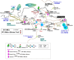
Free Trail Map
Suganuma - Midagaike - MT.Nikko-shirane - Refuge - Goshikinuma - Goshikiyama-bunki
- Suganuma Total distance 11.1km Total time 6hrs.
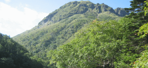
Mt. Shirane is located on the border between Gumma and Tochigi prefecture.
Another Mt. Shirane is also in Kusatsu area. So Mt. Shirane in Nikko area is called Mt. Nikko-shirane and Mt. Shirane in Kusatsu area is called Mt. Kusatsu-shirane.
Mt. Nikko-shirane belongs to Nasu Volcanic Belt and the peak in Mt. Nikko-shirane
is Mt. Oku-shirane which is highest in northern area from Kanto region.
You can see Cyuzenji-lake, Mt. Mae-shirane, Mt. Nantai, and big bogs like
cobalt blue Goshikinuma, Suganuma, and Marunuma. The route through Mt.
Oke-shirane and Mae-shirane is also popular. It takes 2.5 hours to reach
to the summit if you use the gondola from Marunuma plateau.