TOP]Tohoku Region
MT.Adatara][How to go there][Accommodation]
trail1][trail2][trail3][trail4trail5][trail6
MT.Adatara

Recommendation season
From middle of May to end of October.
The elevation of this trail is from 945M to 1700M.

Free Trail Map
Okudake - Seshidaira - Kurogane Hut - Minenotsuji - MT.Adatara - Sennyodaira - Yakushidake - Okudake
Total distance 8.5km
Total time 6-7hrs.
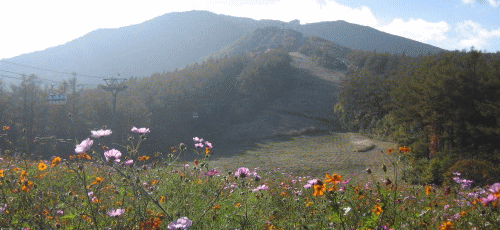
Mt. Adatara is volcano located in the middle of Fukushima prefecture. There are the ranges of Kimen-san, Minowa-yama, Tetsu-san, Adatara-yam, and Osho-yama. Mt. Adatara looks like a nipple from far, which is "chikubi" in Japanese, and another name is Chikubi-yama. If you use gondola between Oku-dake and Yakushi-dake, you can reach to the summit for 1-2 hours. This is as popular as Mt. Bandai.
Copyright(c) TOZAN. All rights reserved.
Base template by WEB MAGIC.